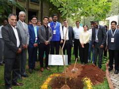
The setting up of India’s first DORIS ground beacon at Indian Institute of Technology, Kanpur, is an important but somewhat under-the-radar step in India’s space and earth observation capabilities.
DORIS — short for ‘Doppler orbitography and radio-positioning integrated by satellite’ — is a French system that tracks satellites and ground stations with centimetre-level accuracy.
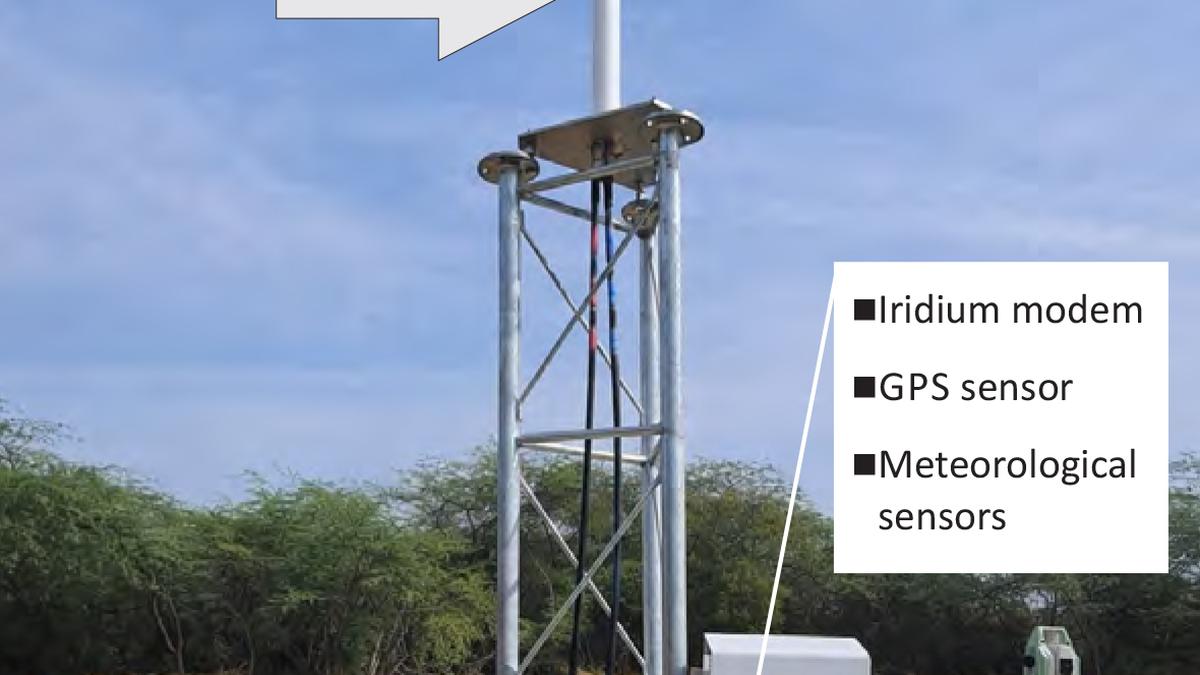
The beacon at IIT-Kanpur is part of a global network of DORIS ground stations.
Satellites carrying DORIS receivers use signals transmitted from these beacons to calculate their own position precisely.
Because a satellite moves very fast overhead, the frequency of the signal changes slightly due to the Doppler effect — the same effect that makes a passing train horn sound different as it moves away.
By measuring these tiny frequency shifts from beacons around the world, the satellite can calculate its exact position and speed.
This accuracy is crucial for missions involving ocean altimetry, climate studies, mapping the earth’s gravity field, monitoring sea-level rise and glacier movement, tracking tectonic shifts, and precise satellite orbit determination.
A satellite measuring ocean height, for instance, may detect just a few millimetres of change per year.
That measurement becomes meaningful only when scientists can know the satellite’s orbit with centimetre-level accuracy.
Otherwise, they cannot tell whether the ocean rose, or whether the satellite drifted slightly.
DORIS helps remove that uncertainty.
The system has been used in major international satellite missions such as Jason, Sentinel, CryoSat and the Indo-French SARAL/AltiKa.
The beacon at IIT-Kanpur strengthens India’s role in global space geodesy — the science of precisely measuring the earth’s shape, rotation and gravitational behaviour — and deepens Indo-French cooperation in the space sector.
Systems like GPS, VLBI (radio astronomy timing), laser ranging and DORIS together form the backbone of modern earth measurement.
Benefits for India “The establishment of the DORIS beacon in India represents enhances the national geodetic infrastructure and participation in the global geodetic community,” says Prof Onkar Dikshit of IIT-Kanpur.
“It will help establish a highly accurate and stable national terrestrial reference framework for surveying, mapping, infrastructure development, satellite navigation, disaster management, smart city planning, and other strategic applications,” he said.
In addition, the Indian subcontinent is tectonically active due to....
/socialsamosa/media/media_files/2026/05/29/misleading-claims-in-health-food-advertising-2026-05-29-17-14-42.jpg)